Active Weather Expected To Continue Into February
Several back to back systems have given the Ag community reason for excitement. After a very dry December and a dry start to the New Year, Marilyn Lohmann with the National Weather Service says the area finally received some much needed snow. She said the Cascades were one of the main beneficiaries.
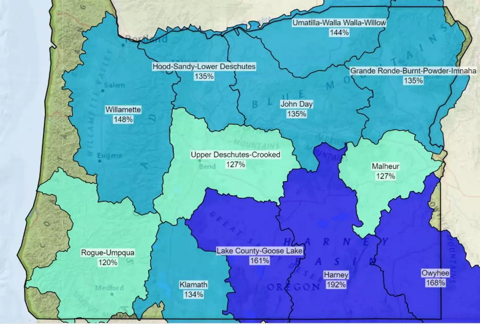
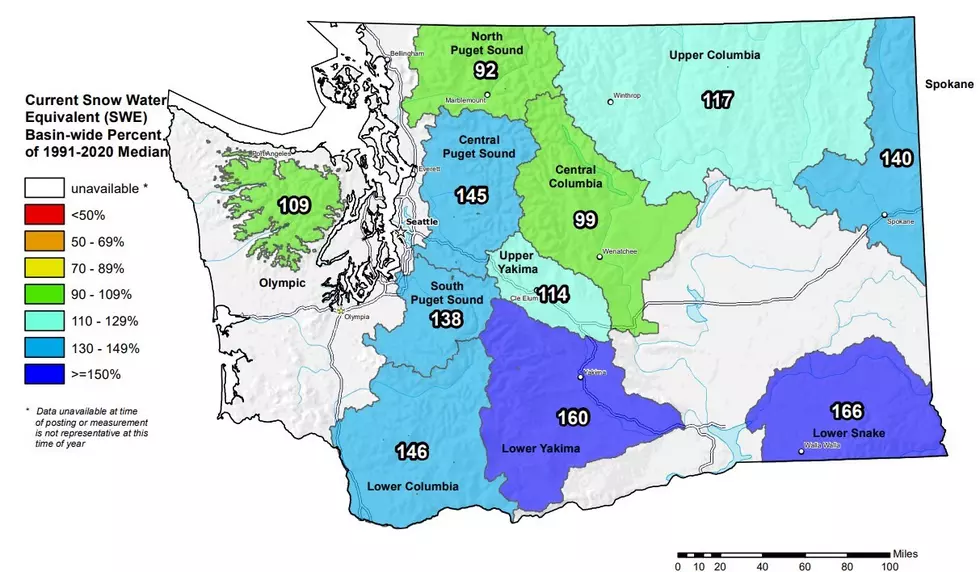
“Over the past 30 days they’ve seen about 100% to 150% of normal precipitation and the northern Blue Mountains as well. Not quite so well for the southern Blue Mountains. But all in all a really good change from what we received in late December.”
While the higher elevations have received a lot of snow, the same cannot be said for the lower elevations. Lohmann says over the past 7-10 days, locations like Yakima, the Tri-Cities, Moses Lake and Wenatchee have only received 0.1” of an inch of rain. Other locations, such as Pendleton, Walla Walla and Pullman saw more rain, between 0.25” and 0.33”.
As we look ahead, Lohmann says temperatures are expected to be above normal and above normal precipitation. Meaning out snow levels will increase to 5,000’-6,000’ this weekend, but Lohmann does not anticipate much if any mountain melt off.
If you have a story idea for the Washington Ag Network, call (509) 547-1618, or e-mail gvaagen@cherrycreekradio.com
More From PNW Ag Network