Dry Pattern Not Expected To Change Anytime Soon
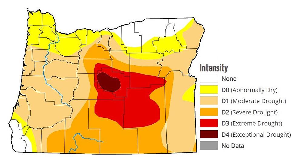
April looks to wrap up the way is started; dry.
Marilyn Lohmann, meteorologist with the National Weather Services says in the final days she does not anticipate anything outside of an isolated thunderstorm in the higher elevations, and she noted that is very unlikely right now. In fact this very strong warming trend will continue through the end of the week, with some locations approaching the uppers 80’s and perhaps 90 on Thursday.
“But then we do have a couple of systems maybe in the weekend that are going to kind of beat down that ridge of High Pressure that gave us those really warm temperatures, and bring us back a little more toward normal with some 70’s. But it seems we’re going from one extreme to another which is kind of our typical spring weather. But unfortunately in the midst of that, we’re not seeing a lot of precipitation for the area.”
Lohmann added if any showers do roll in with this weekend’s systems, she does not expect the showers to make it over the Cascades.
How dry was the month of April, and how dry has 2021 been? Check out our Podcast to learn more.
If you have a story idea for the PNW Ag Network, call (509) 547-1618, or e-mail gvaagen@cherrycreekmedia.com
More From PNW Ag Network
