Dry Weather Expected To Continue Across The Northwest
Much of the Pacific Northwest has experienced windy and cloudy conditions over the past couple of days, with drastically cooler temperatures. Unfortunately, while this system has brought it those winds, it does not look like rain is part of the package.
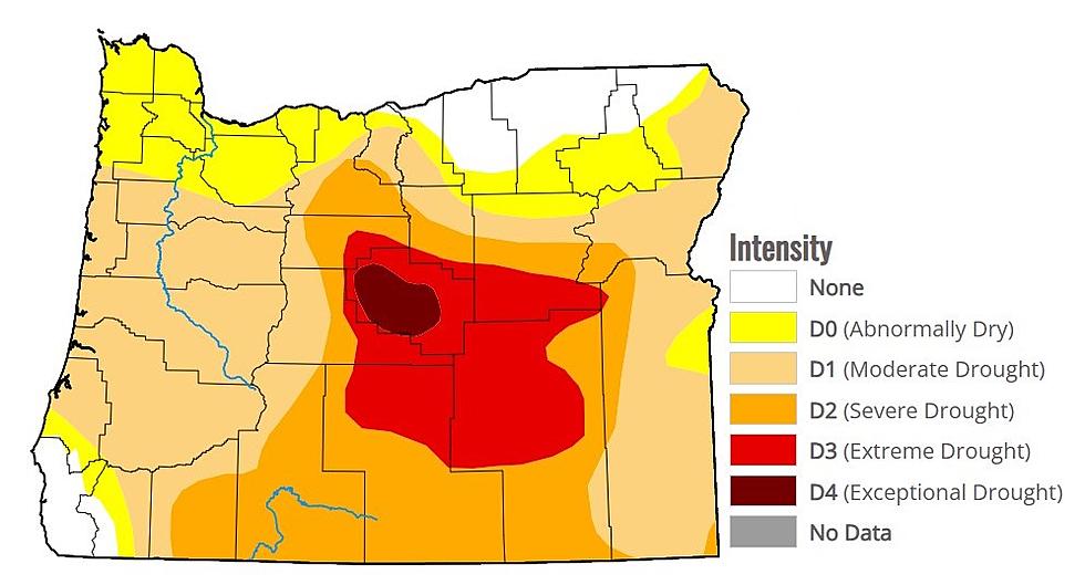
Marilyn Lohmann, meteorologist with the National Weather Service says the winds from the first half of the week created dust storms, reducing visibility. She noted dust storms are not typical in mid-May, but the entire Northwest right now is well below normal in the rain bucket, with February’s snow the last major precipitation events many communities enjoyed.
“When you take a look at March through May, we had record dryness in March, record dryness in April and we’re still on pack to be record dryness in May. And actually, it stretches back to the fall. IF we look at the long-term record there, we got 25%-50% of average precipitation stretching from central and north central Oregon all the way up to south central and eastern Washington.”
And this cold front that’s rolling over the region is not expected to bring much rain, outside of very isolated showers in the higher elevations along the mountains. And for those not a fan of the cooler windy weather, feat not.
“We do expect this upper level low and those cooler temperatures to remain over us through Friday, or so, and then we will start warming back up again.”
Lohmann noted with this cold front, it is possible some locations will see very chilly overnight lows, which will keep fruit growers on their toes.
If you have a story idea for the PNW Ag Network, call (509) 547-1618, or e-mail gvaagen@cherrycreekmedia.com
More From PNW Ag Network


