While Temperatures Moderate, Dry Conditions Persist
To say the first week of weather in June has been all over the map may be an understatement. Last week, the Northwest saw temperatures climb into the upper 90s with some triple digits recorded. Then, over the weekend, the the strong ridge of high pressure that brought in extremely hot temperatures broke down, allowing clouds and cooler temperatures to move into the area. Marilyn Lohmann, meteorologist with the National Weather Service said the low pressure system didn’t bring much rain, but rather a lot of wind, which she pointed out has been typical for this spring.
“For May, our normal winds on a good day are around 10 mph, average out to about 10 mph. And over most of the month of May, for a good 15-20 days our average winds were 15-20 mph.”
Will the region see any rain showers in the back half of June?
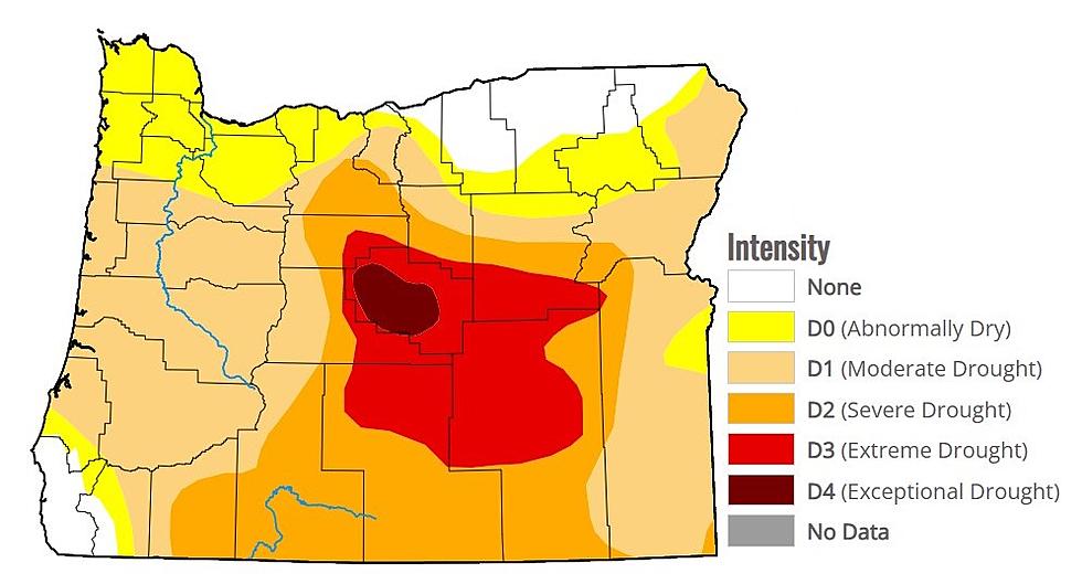
Lohmann says at this point, the chances are very slim. And she doesn’t expect a reprieve from this dry weather anytime soon.
“Beyond the 30 day outlook of above normal temperatures and below normal precipitation, the three month outlook, out into July, August and September show that same pattern. Not to say we won’t have any rainfall, but it’s not going to be anytime right now, it doesn’t seem to be wide spread and that really wetting rain that we would like to see.”
Lohmann said the cloudy, and slightly below temperatures will continue for a few more days.
But as we look to a new week, she says temperatures are expected to increase.
If you have a story idea for the PNW Ag Network, call (509) 547-1618, or e-mail gvaagen@cherrycreekmedia.com
More From PNW Ag Network


