Lohmann: Rain Unlikely Through The End Of The Month
No surprise, June was a month of records with extreme temperatures of 118 recorded in two locations in southern Washington, as well as a handful of other communities across the Northwest well into the 110s, but the hot, dry weather must come to an end soon. Right?
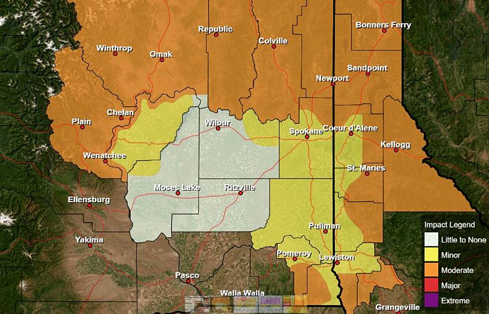
Unfortunately it won’t change anytime soon. Meteorologist Marilyn Lohmann with the National Weather Service says the heat we experienced last month was thanks to a High Pressure System parked over the Northwest, allowing the mercury to rise rapidly. While that High Pressure has now moved down to the four-corners region of the Southwest, 2021 will remain dry.
“Sometimes that can get us some moisture up the Sierra-Nevada’s and in [to the Northwest], but this year, that High Pressure is in a different spot, so I don’t see a lot of moisture being able to work its way up into our area at this time. And that kind of extends out through the end of the month even. So, maybe a better hope as we move into August.”
Lohmann noted models show a few systems from the Northwest could drop into our region, brining slightly cooler temperatures moving into the weekend, but any relief will be short lived. Lohmann added while temperatures have remain very high over the past couple of weeks, the Northwest is enjoying cooler overtime temperatures, which provides some relief.
Could this hot, dry pattern be the work of La Niña? Check out our entire podcast for the answer:
If you have a story idea for the PNW Ag Network, call (509) 547-1618, or e-mail gvaagen@cherrycreekmedia.com
More From PNW Ag Network